 Copy
Copy WhatsApp
 Facebook
 Telegram
 X
X LinkedIn
 Email
Email Reddit
 Pinterest
 Line
Line VK
VK Blogger
 Tumblr
 OK
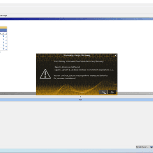
OKGlobal Mapper 21.1 is a GIS (Geographic Information System) software developed by Blue Marble Geographics. It is used for spatial data management, analysis, and visualization, supporting a wide range of file formats and offering tools for both 2D and 3D geospatial workflows.
This version, 21.1, includes enhancements over earlier versions and continues Global Mapper’s reputation for being affordable, user-friendly, and powerful, especially for professionals working in surveying, mapping, remote sensing, environmental studies, forestry, and civil engineering.
🎯 What the Program Is Used For:
Global Mapper 21.1 is a versatile desktop GIS application used to:
-
View and convert vector, raster, and elevation data
-
Perform terrain analysis and contour generation
-
Create and edit maps
-
Conduct spatial analysis, such as buffering, viewshed, line of sight, and watershed modeling
-
Manage LiDAR and point cloud data
-
Export data to a wide range of formats or directly to CAD/GIS systems
🛠️ Key Features in Global Mapper 21.1:
✅ Wide Format Support
-
Supports over 300 spatial data formats, including SHP, GeoTIFF, LAS/LAZ, DXF, KML, and more
✅ 3D and Terrain Visualization
-
Display and analyze elevation data in 3D
-
Create hillshades, slope maps, cut-and-fill calculations, and terrain profiles
✅ Point Cloud and LiDAR Tools
-
Classify, filter, edit, and extract features from LiDAR and point cloud data
-
Generate DTM/DSM and contours from point clouds
✅ Digitizing and Map Creation
-
Create and edit vector features manually (points, lines, polygons)
-
Apply styles, labels, and symbology for high-quality cartographic output
✅ Raster Processing
-
Reproject, mosaic, tile, and transform raster data
-
Generate NDVI and other indices from multispectral imagery
✅ Scripting and Automation
-
Use the Global Mapper Script language to automate repetitive tasks and batch processing