
 Copy
Copy WhatsApp
 Facebook
 Telegram
 X
X LinkedIn
 Email
Email Reddit
 Pinterest
 Line
Line VK
VK Blogger
 Tumblr
 OK
OKMicroSurvey FieldGenius 9.2 is a surveying software used for field data collection and surveying operations. It is developed by MicroSurvey Software, Inc., and is designed for use with total stations, GNSS receivers, and digital levels. This software is commonly used by surveyors, civil engineers, and construction professionals to collect and process field data efficiently.
🎯 What the Program Is Used For:
MicroSurvey FieldGenius 9.2 is used for:
-
Data collection during land surveying, construction, and civil engineering projects
-
Field measurements with total stations, GNSS equipment, and digital levels
-
Real-time data visualization and processing to create accurate survey results
-
Stakeout, boundary marking, and as-built data collection
-
Data transfer between the field and office for further analysis and reporting
🛠️ Key Features of MicroSurvey FieldGenius 9.2:
✅ Field Data Collection
-
Compatible with a wide range of survey instruments, including total stations (e.g., Leica, Topcon, Sokkia), GNSS receivers, and digital levels
-
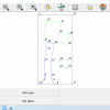
Collect points, lines, and arcs for various surveying tasks such as boundary surveys, topography, and construction staking
-
Supports auto-levelling and real-time data validation for accurate measurements